

It was a message from my cousin that came out of the blue: "Let's ride to Daraitan this Saturday!".
I would always love to go but my motorbike's condition might put me into risk so I had to drop the idea. But it felt like I was destined to experience Daraitan that weekend when another invite from a colleague came the next day while we're heeding nature's call at the urinals placed next to each other. The feat, summiting Mt. Daraitan.
 |
| Mt. Daraitan behind thick clouds |
Mt. Daraitan
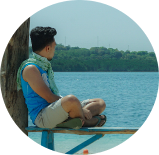
A call from work mates awaken me at around 5:00 AM. They're on their way to Tanay coming from Mandaluyong while I'm on my way to the shower. I live just an hour away from McDonald's Tanay where we took our breakfast, grabbed our lunch and chartered a tricycle that would take us to Brgy. Daraitan. We grabbed some beer at 7-Eleven to supposedly chug down at the summit, fueled-up at a gas station, then hit the road.Daraitan is a far-flung village. It's an hour and a half drive along a network of dusty, unpaved road, and that ass-numbing tricycle ride came with a confab with our driver. Daraitan borders Quezon and Laguna provinces, and from what I heard, illegal logging was rampant before Tanay's local government turned Daraitan into an eco-tourism village. After this preservation effort, municipalities of Sta. Maria, Laguna and Tanay, Rizal had have a dispute over which jurisdiction Daraitan should fall under. He's sharing his sentiments about this territorial dispute until we halted at a ridge to take photos of Mt. Daraitan's summit hidden behind thick clouds that morning.
 |
Tricycles usually do stop over for tourists to take that customary photo. We then crossed a sturdy wooden bridge few kilometers before reaching the village center. Before the bridge was built, vehicles tend to cross the river themselves so for its continued maintenance, caretakers collect a minimal fee per passing vehicle.
At 8:00 AM, the village center was already bursting with trekkers settling the necessary fees at the barangay hall. Sari-sari stores and food stalls lining up the gutters sell refreshments, snacks and some basic hiking gears. I got myself an arm gloves which was just perfect for hiking and city riding as well. We secured a tour guide, listened to a brief compulsory orientation and the show began.
 |
About two hours of arduous climb and bicep-pumping grips on stiff branches and rock formations along Mt. Daraitan's well-maintained forest trail, we made it to the jam-packed summit. A man of late 40's serving as the "crowd control" organized the queue of hikers who would step upon the enthralling limestone formation which serves as a platform for group photos and a vantage point of the Sierra Madre mountains and the meandering Daraitan River.
 |
| Enthralling limestone formation at the summit |
 |
| View of Daraitan River at the summit |
Hikers were asked to stay at the summit for a limited time to give chance for others to relish the marvelous vista, so the plan of savoring a can of beer would be impossible to carry out. We munched on our packed lunch at one of the camp sites then started the kneecap-tearing descent bound for Tinipak River.
Tinipak River
It was a relief hearing a mixed sound of gushing stream and indistinct clamor. Tinipak River was within reach at last. We stepped out of the forest and trekked along a rocky trail for about ten minutes and reached Tinipak Campsite blanketed by a number of pitched tents. We paid the necessary environmental fee and started trekking along makeshift wooden ladders and bridges, and voilà! Large enamel white rocks scattered around the region feasted our eyes. It's as if a mythical giant creature shattered a humongous boulder and the bits formed that marvel (that's actually how Tinipak's legend was told). We're about to take a plunge but our guide suggested to visit a cave first. We obliged. |
 |
We trekked across large boulders to get into the other side of Tinipak River where a crowd noticeable from afar seemed like hikers were just taking a rest under the shady trees of Mt. Mamara (the mountain adjacent Mt. Daraitan where Tinipak River flows in between them). We arrived and found out that it was a long queue for the cave entrance. It would have been the longest hour of my life that time if I did not get exhausted from the hike. An hour of waiting in line was just enough to recover and prepare for another challenging trail on that trip of never-ending treks.
 |
We braved a five-minute trek deep down a dark trail with uneven, sharp-edged and slippery limestone paths to reach the natural freshwater spring beneath. The underground pool was already too crowded of partying visitors for us to enjoy a dip so we got out after a short while and reveled in the Tinipak River instead. We found a not-so-crowded part of the river near a spring considered sacred by the native Dinagat tribe of Tanay and Gen. Nakar and let the beers sit for minutes in the cold water spring. It's beer and plunge time, finally.
 |
We trekked back to the jump-off point just before sunset and called it a day. Been there, done that.
 |
How to reach Brgy. Daraitan? Check Pinoy Travelogue's Daraitan travel guide.
Mt. Daraitan Experience: Destined for Daraitan : Tinipak River and Mt. Daraitan Experience
Daraitan Travel Guide: Trip Guide: Mt. Daraitan Day Hike and Tinipak River
Daraitan Travel Guide: Trip Guide: Mt. Daraitan Day Hike and Tinipak River
ABOUT
DJ Rivera is an I.T. professional, entrepreneur, travel blogger, writer and the online publisher of PinoyTravelogue.com based in Rizal province, Philippines. Click here to know more.
